VIEW SAMPLE CHARTS DISPLAYED ON OUR PC/MAC & SMART PHONE/ TABLET COMPATABLE CHART VIEWER & PLOTTER, NO APPS NEEDED
GPS REAL TIME TRACKING INCLUDED
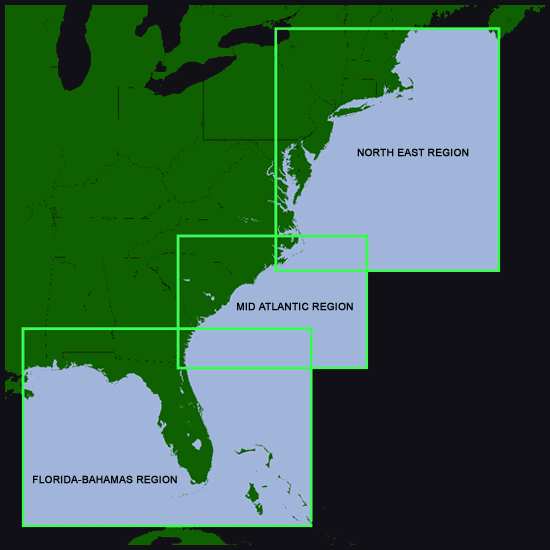
SUBSCRIPTIONS--->WE OFFER TWO (2) SEPERATE REGIONAL SUBSCRIPTIONS: The North East region and the Florida Bahamas Mid Atlantic region.
The North East Region shown below INCLUDES 3 separate zones while
The Florida/Bahamas/Mid Atlantic Regions shown below come bundled together in one subscription.
Instructions
This is a fully functioning map interface identical to those used in our members areas. You can see exactly how your PC laptop smart phone or tablet will look and work with our charts using this interface.
Other controls available allow you to add delete or save waypoints, flip through older charts for comparison and select between three Latitude Longitude formats.
You can also save several charts for use while offshore when no phone service is available. GPS real time tracking will be active even when phone service has quit and will mark your position on the saved charts all with no phone service needed.
REQUIREMENTS---> Google Chrome, Firefox, Safari and all recent browsers.
1. To see SST and Chlorophyll/Ocean color sample charts simply select (click on) a region you are interested in and a mapping interface will open up.
2. Click on the button that reads "Control Panel" on the upper right hand corner of the screen. The interface control panel will open up.
3. Select the arrow next to zone to see other zones (NOTE: the MA region has only one zone) Select "Pass Date & Time" to see older passes.
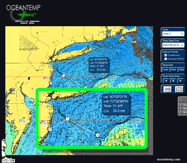
Map interface demo using old charts.
Samples of our OceanView mapping interface are pictured below with 2 screen shots. The interface is user interactive and will allow the user to be able to freely roam and zoom in and out as close or as far as desired within large areas called ZONES. The interface also gives constant Latitude/Longitude positions in three formats, distance measurement in nautical miles and display real-world magnetic headings. A waypoint feature and chart "slide show" are also included. ( Please note that the look of the control panel and some features may have changed with newer updated versions of our interface).

Please note that some features and the overall look of
the mapping interface on this video may have changed
with newer and more recent updated versions along with
new features not mentioned on the video).
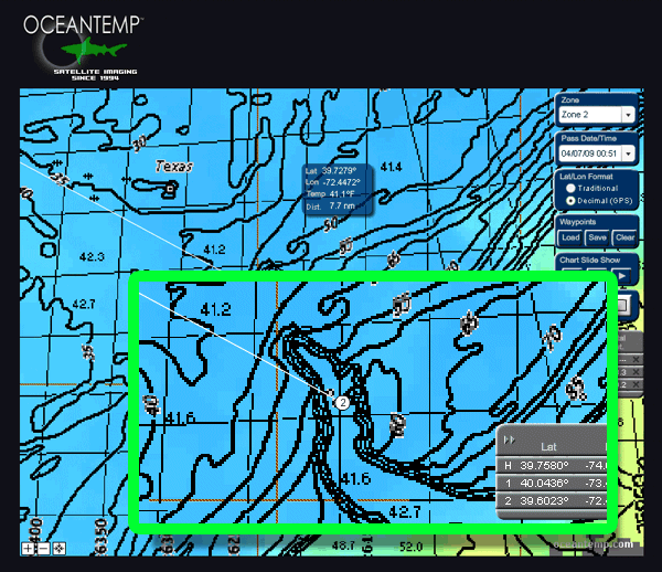
Same interface image below however now "zoomed in" on Hudson canyon.
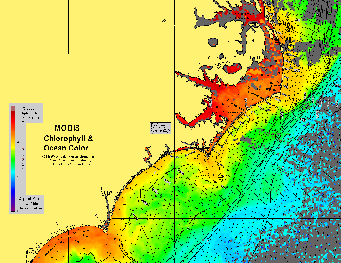
Below: Sample portion of a MODIS Chlorophyll (Ocean Color) chart. These charts display slightly different colors then the normal SST charts and read "MODIS CHLOROPHYLL & OCEAN COLOR" along with a color bar legend on land areas. (Note: These charts do not display temperatures in the information bubble)