National
Buoy Data Center: (left click
on any link to go there)
Weather
Forecasting and Related Subjects:
TIDES
WIND AND CURRENTS:
----------------------------------------------
Live!
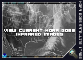
"Real Time" GOES animation for monitoring Cloud Cover.
Click on the image to the right to see a�continuously
updated,�real-time "live feed"�animation of�the last four hours
of actual NOAA/GOES satellite releases. These images will give you
a good idea of the�CURRENT cloud conditions�plus conditions� spanning
the last (4) hours.�The animation engine has its own controls that
you may use to pause, speed up, or slow down the animation! �
Goes satellite�Images are�low resolution photos�that are�mainly
used to track large weather systems across large sectors of the
earth's surface. Goes satellites are stationary and reside�far out
in space (about 35,000 miles)�and do�NOT orbit the earth,�as do�the
high resolution�Polar satellites that�we use for SST charts do.
(The time registered on the images are GMT).