Welcome to Oceantemp™ Satellite Imaging, a foremost manufacturer
and provider of highly and unusually detailed sea surface temperature
charts (SST charts) since 1994 to both sports fisherman and professional anglers
alike. In fact nearly half our clientele is made of up professional
charter boat captains.... that's a fact!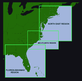
Since our humble beginnings, we have upgraded our equipment and the service and quality of our products over and over, year by year in an effort to provide our members with the ultimate in clear, precise and easy to read sea surface temperature charts. See what sets our SST charts apart from the competition even to this day!
We are NOT a "discount" service as some of the very expensive providers have claimed and as our nominal fee may suggest. We manufacture our own SST and Chlorophyll Ocean Color products in our own lab using both our own developed proprietary software in conjunction with military grade software to process only the finest data available. Our raw data is purchased from professional sources who employ satellite dishes costing in excess of several hundred thousand dollars. Because we purchase our raw satellite data instead of owning a high maintenance expensive satellite dish and maintenance crew, we can pass the savings on to our customers and actually deliver better quality products then the biggest of the so-called "big guys". Because we purchase duplicate data from several sources, we have plenty of "backup" in case one source fails and this means "dependable" service with no down time. There is nothing "discount" about our service or products except our prices and now you will be able to use your charts offshore with real time GPS tracking. Our downloadable charts will allow you to view and use your charts with GPS even after you have lost phone service!
High Resolution Satellite Photo Images. Take a look at our sample charts which are the best example of what you will get with Oceantemp™ SST & Chlorophyll charts. You will not see any other chart product with the accuracy and attention to detail that we incorporate. We challenge you to find this level of detail from any other provider weather they charge $149 or $949. It's just not going to happen. On top of that we also inspect all products--->click HERE to find out how.
How can our service benefit you?
It's simple ... just like our members have discovered for over a
decade, we will help you catch more fish, faster and with less guesswork
and for less cost! We will do this by getting you where you need
to go to find temperature breaks with Geographical and Thermal accuracy. Our charts are displayed and presented on our own, easy to use, interactive chart interface that is fully compatible with any PC (Mac or Windows) and all smart phones and tablets with NO confusing apps needed! We also offer you a full year of access, not just limited number of access permits that run out
in no time.
We have used our own charts out on the actual ocean and we know exactly what they can do, how easy they are to read and and how accurate they can be. Please Join us for a season and you will see what we mean and why half of our customers are professional charter boat captains. We guarantee that you will NOT find any better charts anywhere for any price. If you are looking for good, solid dependable service and temperature charts at an affordable price you have come to the right place. We may not be the least expensive (you get what you pay for) however we are affordable and the best!
Thank You,
Oceantemp Crew!

"Oceanview" online mapping/plotting Interface
